

Google Street View Comes to Italy
· Updated · BootsnAll
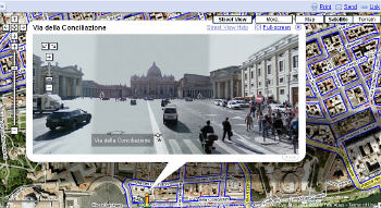 Google Street View came to Italy in October 2008 with just four places: Rome, Florence, Milan and Lake Como. I was ridiculously excited about it. Today the little yellow Pegman can drop onto almost any road in the country, plus a surprising number of places no car can reach. For trip planning it's one of the most useful free tools there is.
What you can see on Street View in Italy now
- Almost every road. Coverage spread from the big cities to the whole mainland, Sicily and Sardinia within a few years of launch. Village lanes too narrow for the camera car are the usual gaps.
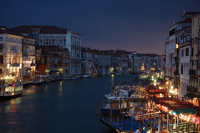
- Venice from the water. In November 2013 Google added Venice, shot on foot through the calli and from boats along the canals, which is as close as you'll get to a free gondola ride.
- Ancient Rome up close. The Colosseum, the Roman Forum, the Palatine Hill, the Baths of Caracalla and a long stretch of the Appian Way were added in 2011, along with Villa d'Este in Tivoli. The Catacomb of Priscilla followed in 2013, so you can go underground from your couch.
- Pompeii. You can walk its ancient streets, which is a smart way to decide which houses you'll hunt down on the day (the site is huge).
- Florence's showpieces. Piazza del Duomo, Palazzo Pitti and the Boboli Gardens are on Street View, and museum interiors, the Uffizi among them, are viewable through Google Arts & Culture.
- Islands and mountains. Elba, Capri, Procida, the Tremiti Islands, Pantelleria and part of Lampedusa are covered, and there's imagery from high on Mont Blanc and from Italian ski resorts.
- User photos everywhere else. Blue dots on the map are 360-degree photos uploaded by ordinary users, and they fill in plenty of beaches, trails, churches and restaurant interiors. Quality varies wildly.
Google Maps also has Immersive View in Rome, Florence, Milan and Venice: a 3D model built from Street View and aerial images that lets you fly around a landmark and see it at different times of day. It's fun, but plain Street View is still the more useful planning tool.
How to use Street View to plan an Italy trip
- Check your hotel's street before you book. "Steps from the Spanish Steps" can mean a noisy junction. Street View shows you the entrance, the traffic and whether there's a bar with outdoor tables under your window.
- Walk the route from the station. Dragging a suitcase over cobbles, up stairs or across four Venetian bridges is a different trip from rolling it along a flat sidewalk. In hill towns, Street View shows you exactly how steep "a short walk up" is.
- Find the parking and the ZTL signs. If you're driving, look at the entrance to a town center before you arrive. Limited traffic zone (ZTL) signs and cameras are visible on the imagery, and they're where rental-car fines come from.
- Check the date. Every panorama shows when it was captured. In Italy some back streets haven't been reshot in years, so the shop you're looking at may be long gone. On many streets you can open "See more dates" and step back through older imagery, which is also a lovely way to see how a place has changed.
Google shut down its separate Street View app in March 2023. Everything above now lives inside the regular Google Maps app and website, and people who want to publish their own 360-degree photos use Street View Studio.
My own Italy on Street View
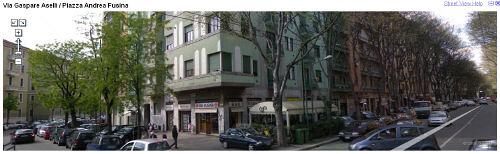
When Street View first arrived I spent far too long visiting my favorite places. There was what I still think of as my corner bar in Milan (oh, how I missed Bar Fusina!):
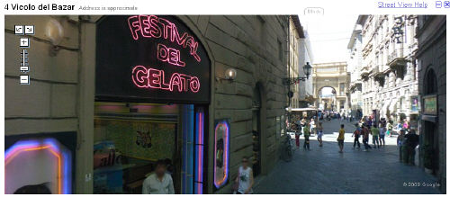
The neon glow outside my favorite gelato shop in Florence:
And a quiet stroll through Trastevere in Rome:
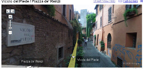
I even got a little choked up when I found the front door of the apartment building in Milan where my husband and I had lived for six weeks. These screenshots are from 2008, so the streets have been reshot since and yours will look different. Go find your own corner of Italy. Just don't plan on getting any work done for the rest of the day.